![](/images/other/stat-length.png)
![Tocht Stappen Le Lorrain - Boucle Morne Ceron 01 - Photo](https://media.geolcdn.com/t/1900/400/ext.pjpeg?maxdim=2&url=https%3A%2F%2Fservices.sitytrail.com%2FGeolivesWS%2FDownloadMedia.ashx%3FTrailID%3D780680%26Media%3Dfix__20170628101707.jpg)
Boucle Morne Ceron 01
Lamartiniere
Gebruiker GUIDE
![Lengte](/images/other/stat-length.png)
Lengte
15,4 km
![Max. hoogte](https://static1.geolcdn.com/siteimages/upload/files/1508320355ic_sort_altitude_max_24dp.png)
Max. hoogte
445 m
![Positief hoogteverschil](https://static1.geolcdn.com/siteimages/upload/files/1508320355ic_sort_den_pos_24dp.png)
Positief hoogteverschil
629 m
![Km-Effort](/images/other/stat-length.png)
Km-Effort
24 km
![Min. hoogte](https://static1.geolcdn.com/siteimages/upload/files/1508320355ic_sort_altitude_min_24dp.png)
Min. hoogte
28 m
![Negatief hoogteverschil](https://static1.geolcdn.com/siteimages/upload/files/1508320355ic_sort_den_neg_24dp.png)
Negatief hoogteverschil
629 m
![Boucle](https://static1.geolcdn.com/siteimages/upload/files/16400158638029165_repeat_loop_refresh_sync_direction_icon.png)
Boucle
Ja
Datum van aanmaak :
2017-06-28 00:00:00.0
Laatste wijziging :
2017-06-28 00:00:00.0
![Stappen](https://static1.geolcdn.com/sitytour/trail-icons/101.png)
4h11
Moeilijkheid : Medium
![Scan deze QR-code om de tocht te openen in de SityTrail-applicatie](https://capi.geolives.com/qq0zvz2zws4bq2lad0pu/sitytour/trails/780680/qr.png?size=200)
Gratisgps-wandelapplicatie
Over ons
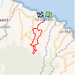
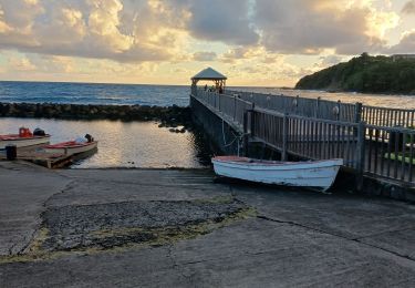
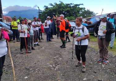
Tocht Stappen van 15,4 km beschikbaar op Martinique, Onbekend, Le Lorrain. Deze tocht wordt voorgesteld door Lamartiniere.
Beschrijving
Les Mornes Ceron, Landau, Icaque, Moreau, Octave, Gustave, Cledelin, Haut-Carabin, Etoile, Vallon, Ceron
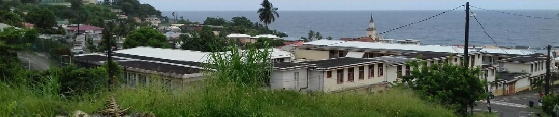
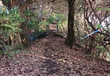
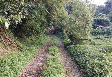
Plaatsbepaling
Land:
France
Regio :
Martinique
Departement/Provincie :
Onbekend
Gemeente :
Le Lorrain
Locatie:
Unknown
Vertrek:(Dec)
Vertrek:(UTM)
709328 ; 1640468 (20P) N.
Opmerkingen
Wandeltochten in de omgeving
![Tocht Stappen Le Lorrain - Boucle Lorrinoise via Morne Wawa - Photo](https://media.geolcdn.com/t/375/260/2260d5fa-b236-443e-94b6-198d12135800.jpg&format=jpg&maxdim=2)
![Stappen Stappen](https://static1.geolcdn.com/sitytour/trail-icons/101.png)
Boucle Lorrinoise via Morne Wawa
Stappen
Medium
Le Lorrain,
Martinique,
Onbekend,
France
![](/images/other/stat-length.png)
9,1 km | 13,9 km-effort
2h 35min
![](https://static1.geolcdn.com/siteimages/upload/files/16400158638029165_repeat_loop_refresh_sync_direction_icon.png)
Ja
![Tocht Stappen Le Lorrain - Boucle Morne Capot via La Pirogue - Photo](https://media.geolcdn.com/t/375/260/88d336cd-6544-44b1-ab6c-880c93dcc1a4.jpg&format=jpg&maxdim=2)
![Stappen Stappen](https://static1.geolcdn.com/sitytour/trail-icons/101.png)
Boucle Morne Capot via La Pirogue
Stappen
Medium
Le Lorrain,
Martinique,
Onbekend,
France
![](/images/other/stat-length.png)
10,3 km | 14,4 km-effort
3h 30min
![](https://static1.geolcdn.com/siteimages/upload/files/16400158638029165_repeat_loop_refresh_sync_direction_icon.png)
Ja
![Tocht Stappen Le Marigot - Boucle Le Mariigot - Charpentier - SLNA. - Photo](https://media.geolcdn.com/t/375/260/b4acbe47-87c5-4bec-aa83-83441bd5fc60.jpg&format=jpg&maxdim=2)
![Stappen Stappen](https://static1.geolcdn.com/sitytour/trail-icons/101.png)
Boucle Le Mariigot - Charpentier - SLNA.
Stappen
Medium
(1)
Le Marigot,
Martinique,
Onbekend,
France
![](/images/other/stat-length.png)
8,7 km | 12,8 km-effort
3h 0min
![](https://static1.geolcdn.com/siteimages/upload/files/16400158638029165_repeat_loop_refresh_sync_direction_icon.png)
Ja
![Stappen Stappen](https://static1.geolcdn.com/sitytour/trail-icons/101.png)
La Crabière-Tapis Vert
Stappen
Medium
Le Lorrain,
Martinique,
Onbekend,
France
![](/images/other/stat-length.png)
7,9 km | 10,3 km-effort
2h 20min
![](https://static1.geolcdn.com/siteimages/upload/files/16400158638029165_repeat_loop_refresh_sync_direction_icon.png)
Neen
![Tocht Stappen Le Lorrain - Mornes Capot / Lorrain Martinique - Photo](https://media.geolcdn.com/t/375/260/bf3e9288-2731-4804-b2e5-dccb9a2b816e.jpg&format=jpg&maxdim=2)
![Stappen Stappen](https://static1.geolcdn.com/sitytour/trail-icons/101.png)
Mornes Capot / Lorrain Martinique
Stappen
Medium
(1)
Le Lorrain,
Martinique,
Onbekend,
France
![](/images/other/stat-length.png)
8,5 km | 11,8 km-effort
3h 41min
![](https://static1.geolcdn.com/siteimages/upload/files/16400158638029165_repeat_loop_refresh_sync_direction_icon.png)
Ja
![Tocht Stappen Basse-Pointe - Boucle de chalvet, Pécoule vers Chalvet. - Photo](https://media.geolcdn.com/t/375/260/1e4cabaa-63c0-46f7-b111-2c87348cf0ee.jpg&format=jpg&maxdim=2)
![Stappen Stappen](https://static1.geolcdn.com/sitytour/trail-icons/101.png)
Boucle de chalvet, Pécoule vers Chalvet.
Stappen
Medium
Basse-Pointe,
Martinique,
Onbekend,
France
![](/images/other/stat-length.png)
6,5 km | 7,8 km-effort
3h 2min
![](https://static1.geolcdn.com/siteimages/upload/files/16400158638029165_repeat_loop_refresh_sync_direction_icon.png)
Ja
![Tocht Stappen Le Marigot - Marigot vers le Lorrain - Photo](https://media.geolcdn.com/t/375/260/6a93875e-8aed-454e-924f-79cf5824df2f.jpg&format=jpg&maxdim=2)
![Stappen Stappen](https://static1.geolcdn.com/sitytour/trail-icons/101.png)
Marigot vers le Lorrain
Stappen
Medium
Le Marigot,
Martinique,
Onbekend,
France
![](/images/other/stat-length.png)
4,8 km | 6,5 km-effort
2h 1min
![](https://static1.geolcdn.com/siteimages/upload/files/16400158638029165_repeat_loop_refresh_sync_direction_icon.png)
Neen
![Tocht Stappen Le Lorrain - Boucle Seguineau 22 Mai - Photo](https://media.geolcdn.com/t/375/260/637e5e8f-3e66-4461-a851-15be19fa887e.jpg&format=jpg&maxdim=2)
![Stappen Stappen](https://static1.geolcdn.com/sitytour/trail-icons/101.png)
Boucle Seguineau 22 Mai
Stappen
Zeer moeilijk
Le Lorrain,
Martinique,
Onbekend,
France
![](/images/other/stat-length.png)
14,2 km | 19,2 km-effort
4h 0min
![](https://static1.geolcdn.com/siteimages/upload/files/16400158638029165_repeat_loop_refresh_sync_direction_icon.png)
Ja
![Tocht Stappen Le Lorrain - Morne Jacob au Panneau ONF - Photo](https://media.geolcdn.com/t/375/260/54159292-758e-4621-a73f-109fb913bb31.jpg&format=jpg&maxdim=2)
![Stappen Stappen](https://static1.geolcdn.com/sitytour/trail-icons/101.png)
Morne Jacob au Panneau ONF
Stappen
Medium
Le Lorrain,
Martinique,
Onbekend,
France
![](/images/other/stat-length.png)
4,3 km | 8,7 km-effort
2h 0min
![](https://static1.geolcdn.com/siteimages/upload/files/16400158638029165_repeat_loop_refresh_sync_direction_icon.png)
Neen
Rando sur reliefs varies, bonne marche